Mangrove Change Analysis & Plantation Suitability
Twenty five years of mangrove cover along the Lasbela coast, mapped and ranked into an evidence base for new plantation.
ClientWorld Food Programme
LocationLasbela coastal belt, Pakistan
The Brief
WFP required an evidence base for coastal mangrove investment in Balochistan: where mangroves stand today, how cover has changed over time, and where new plantation will succeed.
DeliveredWhat we
What we
built
Satellite mapping of existing mangrove stands along the Lasbela coast
A 25-year change record, 2000 to 2025, quantifying the temporal trend
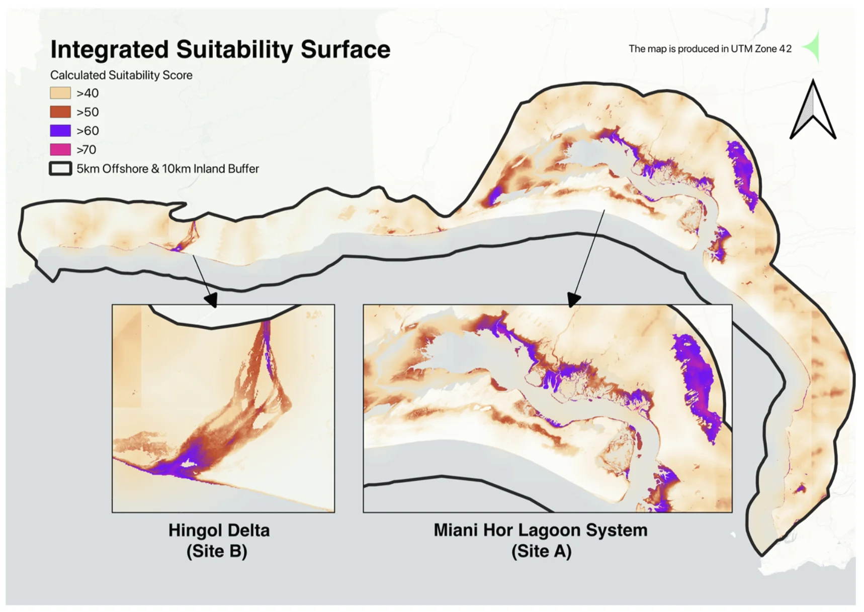
A weighted decision matrix identifying and ranking new plantation sites
The Record
Twenty five years of coastline, read from orbit.
Satellite archives from 2000 to 2025 quantify exactly where mangrove cover persisted, expanded, and retreated along the Lasbela coast, turning anecdote into a measured trend.
2000
2005
2010
2015
2020
2025
25 yearsof change quantified
2000 to 2025satellite record
Ranked sitesfor new plantation
All projectsNext Project
Village Land Intelligence
World Food Programme